|
|
|
Click on these images to see how LandPrints can help you Visualize your Property, then Email us at: |
|
|
|
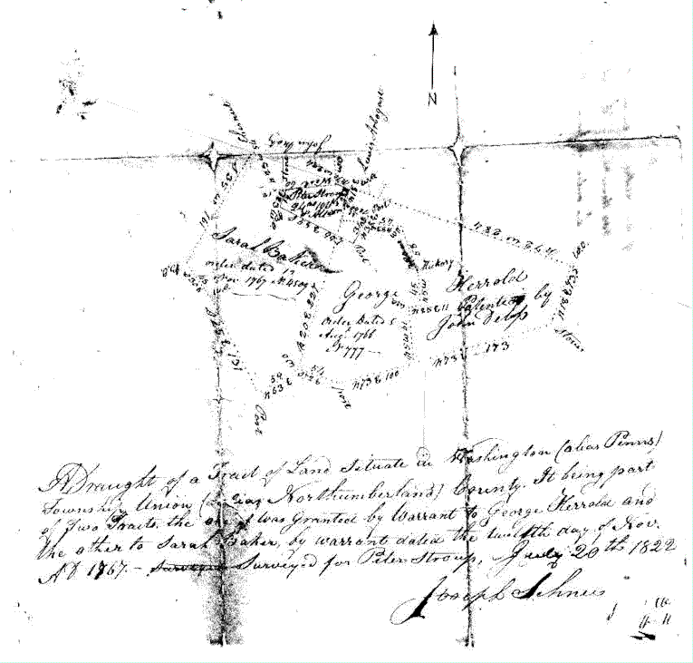
LandPrints computes boundaries based on "metes and bounds" property descriptions. This terminology is usually found in Property Deeds but it also can be found in Mortgage Papers and Sketches, Subdivision Plats, Microfilm Records and sometimes in Wills. You can even generate your own "metes and bounds" text for our analysis, but if you do, be careful to specify each "course" in terms of distance, bearing, and curvature. |
|
|
|
|
Have you ever "settled" on the wrong lot? Have you had any property line disputes lately? Have you ever discovered encroachments like building a fence or garage on your neighbor's land? Ever searched for your great, great, great grandfather's property, having wondered about its configuration and location? Perhaps you are curious about what the land description text in your deed means, but can't interpret it. Well, it is supposed to describe exactly the land you bought. You may have been given a drawing of your lot . . . but does it accurately represent the legal description in your deed? LandPrints can tell you! |
|
|
|
|
|
|
|
|
|
|
|
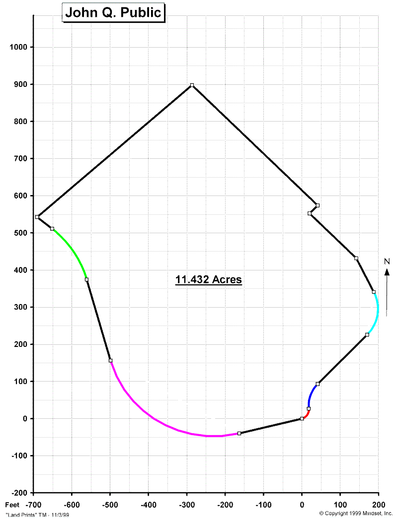
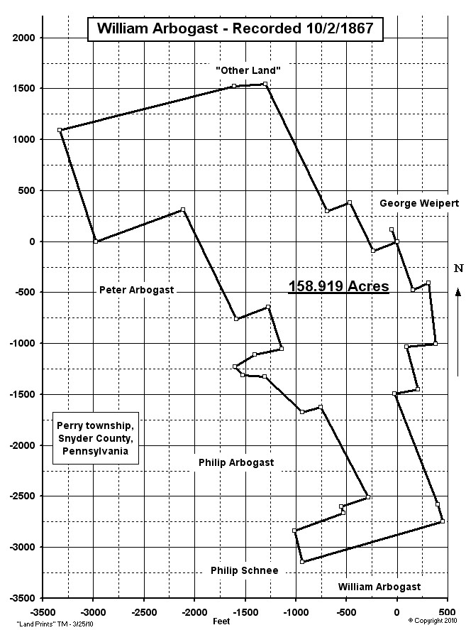
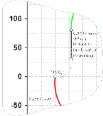
Email your information and we will recommend a path forward and send you a quote. If you accept our terms, we will process the data and send you an 8˝ x 11 plot plus a data page. They will contain the Land Shape and Orientation, the Calculated Surface Area, the Closure Accuracy, and the Input Data used for the calculations. If our analysis implies any encumbrances or disputes, you should seek resolution through normal professional and legal channels. Our service is pretty simple. You send LandPrints your property description and supporting information, then we apply the mathematics, make the calculations, and present the results for a very modest fee. |
|
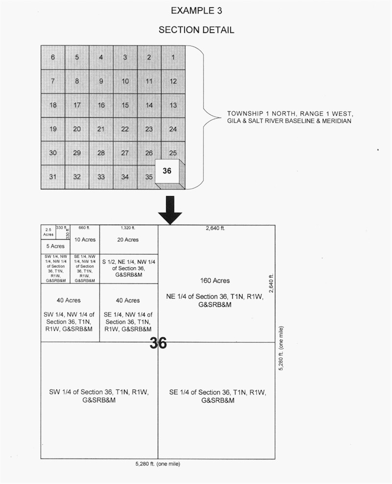
If you live in that part of the United States West of the "Colonies", your land may be specified using the "Rectangular Survey System". It is also called the "Public Land Survey System" (PLSS). LandPrints can provide the same service described above and also locate property. |
|
|
|
|